
AlpineQuest Off-Road Explorer
Download for Android This app is available for Android only.- Category:Nav
- Rating:
- Language:English
- Updated:2026-11-18
Screenshots
Introduction
AlpineQuest Off-Road Explorer is a highly powerful navigation application. It allows users to view maps for any desired area and supports offline map usage. The app offers a variety of map types—including topographic, road, and satellite maps—enabling users to clearly examine the terrain of a given region and determine whether it meets their specific needs. The software also supports the import of map files for offline use. Integrated with GPS positioning, it provides real-time tracking and includes an alert system to help ensure user safety. Furthermore, users can add annotations to maps, with the ability to import and export these marked files.
Features
Offline Map Access
AlpineQuest Off-Road Explorer allows you to store maps locally, ensuring they remain accessible even when there is no mobile network connection. You can save maps for entire regions in advance, and an automatic caching feature keeps recently viewed map content readily available. This is particularly useful for activities such as hiking, hunting, sailing, trail running, and other outdoor pursuits where network coverage may be unreliable or subject to change.
Diverse Map Sources
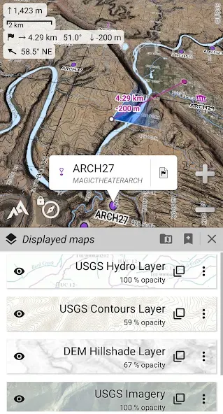
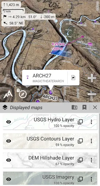
AlpineQuest Off-Road Explorer supports a wide range of map sources, including online topographic maps, road maps, satellite views, hill-shaded layers, contour maps, USGS topographic maps, Swiss topographic maps, and various community-contributed map resources. Since different terrains require different levels of detail, you can select the map type best suited to your route—for instance, contour lines and hill-shaded views help in understanding slopes, while road and satellite layers are ideal for route planning.
Advanced Map File Support
AlpineQuest Off-Road Explorer can utilize various offline map file formats, such as GeoPackage, Memory Map QCT, OziExplorer OZF, MBTiles, GeoTIFF, KMZ layers, and calibrated images. This is essential for users who maintain their own map libraries or utilize outdoor map files from diverse sources. Additionally, the paid version offers broader support for these advanced map formats compared to AlpineQuest Explorer Lite.
GPS Positioning and Route Navigation
You can use real-time GPS and GNSS positioning to track your location directly on the map. AlpineQuest Off-Road Explorer also includes a compass, map rotation, a target finder, and alerts for proximity and off-route travel. These tools help you stay aware if you stray from your planned route or approach a saved location.
Tracks, Routes, and Outdoor Data
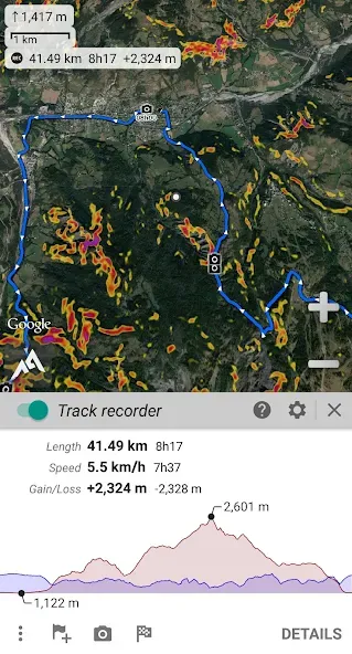
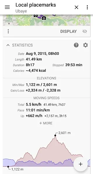
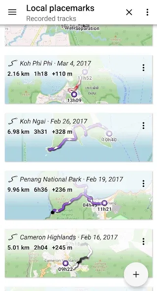
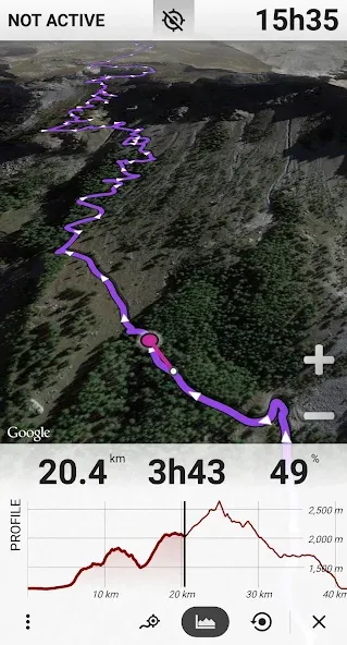
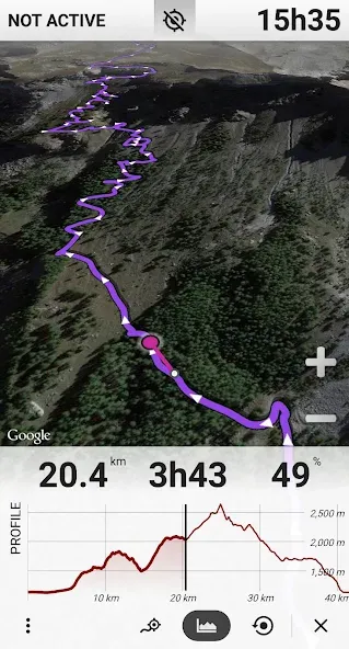
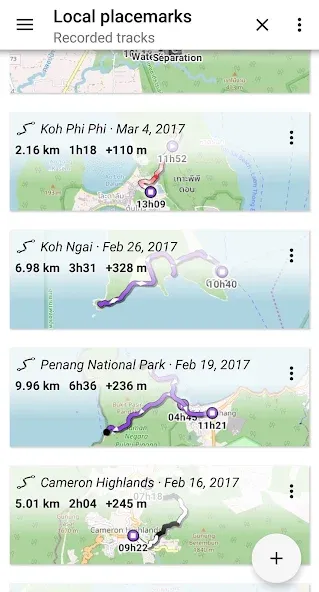
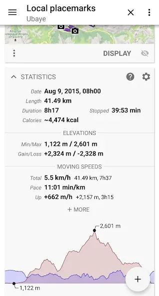
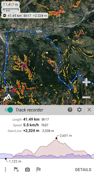
Within the app, you can create and manage an unlimited number of landmarks, waypoints, routes, areas, and tracks. AlpineQuest Off-Road Explorer supports the import and export of GPX, KML, KMZ, CSV, GeoJSON, LOC, IGC, and SHP file formats, allowing route data to be transferred between compatible tools. It can also record long-distance GPS and barometric tracks, providing detailed statistics, charts, and data on elevation, terrain, slope, speed, incline, and pressure.
Usage
Open the app and select a map source suited to your activity—such as topographic, satellite, contour, hill-shaded, or road maps.
Navigate to the area you plan to visit and save the relevant map data locally so you can continue to view it even when there is no cellular coverage.
Add landmarks, waypoints, routes, or areas to mark significant locations, plan paths, identify campsites, note turns, or set return points.
During your activity, use your GPS position on the map to navigate, and take advantage of the compass, target finder, or proximity and off-route alerts as needed.
If you wish to record your journey, track your path; once finished, you can review data such as charts, elevation, speed, slope, incline, and pressure.
Pros and Cons
Pros:
User-friendly and intuitive interface.
Offers a wide variety of map types, including topographic, satellite, and street maps.
Includes features for recording tracks and waypoints to assist with navigation.
Supports real-time tracking, enhancing the outdoor exploration experience.
Allows users to create custom routes and share them with others.
Regular updates from the developer, along with responsive customer support.
Cons:
Some users have reported occasional app crashes or errors.
In-app purchases may be required to access full functionality or additional map resources.
FAQs
How often are the maps updated?
This application simply displays maps sourced from various online providers. The update frequency depends on the editors of the specific map you have selected. In general, the app displays the most recent version available. For instance, if you are viewing Google satellite imagery, you will see the latest images provided by the Google Maps website—though, depending on the specific area, these images may still be somewhat dated.
Can the language of the names displayed on the maps be changed?
Each map follows its own policy regarding the display of names. Default maps use local languages (i.e., localized names), ensuring that users see names in a language and format familiar to them.
Can map download speeds be improved?
Each map relies on its own dedicated server, and download speeds vary accordingly. Several factors can influence these speeds, including your geographical location and the current load on the server.
Conclusion
AlpineQuest Off-Road Explorer is a comprehensive solution for all types of outdoor activities and sports, including hiking, running, off-roading, hunting, sailing, geocaching, cross-country navigation, and much more.
More Information
- Size:8.94MB
- Version:2.4.0c
- Requirements:Android
- Package Name:psyberia.alpinequest.free
- Signature:6489444ff22ab02d557fc9fd20aed95d
Related topics
-
These must-have travel apps bring global adventures to your phone, making trip planning effortless and budget-friendly. Compare flights and hotels in seconds, access offline maps and expert city guides, or master key phrases in foreign languages. Read authentic tips from locals to uncover hidden gems before you arrive. Whether you're dreaming up future journeys or navigating current travels, these tools transform wanderlust into reality. With exclusive free premium features, your digital passport to discovery is ready - download now and let your next unforgettable journey begin!
-
![AlpineQuest Off-Road Explorer]()
AlpineQuest Off-Road Explorer
-
![Map Marker]()
Map Marker
-
![Fake GPS Go]()
Fake GPS Go
-
![Where is my Train]()
Where is my Train
-
![Agoda]()
Agoda
-
![Moovit]()
Moovit
-
![GPS Speedometer]()
GPS Speedometer
-
![Headunit Reloaded]()
Headunit Reloaded
-
-
Nowadays, with the popularity of smartphones, navigation software has become an essential tool for people's travel. Among numerous Android mobile navigation software, some are highly regarded for providing users with convenient navigation services. These software not only have accurate positioning functions, but also can update road condition information in real time, providing users with the best driving route. At the same time, they also offer multiple travel options such as walking, public transportation, self driving, etc., and can intelligently plan routes based on user needs. In addition, these navigation software also have voice navigation function, making it convenient for users to obtain navigation guidance at any time while driving. In short, Android mobile navigation software can provide users with comprehensive route planning services, making travel more convenient and safe.
-
![AlpineQuest Off-Road Explorer]()
AlpineQuest Off-Road Explorer
-
![Map Marker]()
Map Marker
-
![Fake GPS Go]()
Fake GPS Go
-
![Chalo]()
Chalo
-
![Moovit]()
Moovit
-
![GPS Speedometer]()
GPS Speedometer
-
![Wanderlog]()
Wanderlog
-
![Flightradar24 Flight Tracker]()
Flightradar24 Flight Tracker
-
-
Accurate navigation software can not only help users quickly find their destination, but also assist customers in obtaining real-time traffic information and avoiding congested roads. So which navigation software is the most accurate? In order to help netizens better choose the most accurate navigation software, the editor has compiled a ranking list of navigation apps. Through these navigation apps, users can easily access practical information such as gas stations, restaurants, and parking around their destination, making it easier to plan their daily travel plans. At the same time, these navigation apps also provide accurate route planning and navigation services, allowing users to rely on them with confidence to complete accurate navigation.
-
![AlpineQuest Off-Road Explorer]()
AlpineQuest Off-Road Explorer
-
![Map Marker]()
Map Marker
-
![Fake GPS Go]()
Fake GPS Go
-
![Chalo]()
Chalo
-
![BlaBlaCar]()
BlaBlaCar
-
![GPS Speedometer]()
GPS Speedometer
-
![Flightradar24 Flight Tracker]()
Flightradar24 Flight Tracker
-
![Headunit Reloaded]()
Headunit Reloaded
-







Latest Updated
Popular Apps






Popular News
More+-
![Tomie Wants to Get Married Full Walkthrough, All Choices and Ending Guide]()
Tomie Wants to Get Married Full Walkthrough, All Choices and Ending Guide
2026-05-22
-
![Karryn’s Prison Gameplay Walkthrough & Strategy Guide]()
Karryn’s Prison Gameplay Walkthrough & Strategy Guide
2025-10-28
-
![Life in Santa County Game Guide & Complete Walkthrough]()
Life in Santa County Game Guide & Complete Walkthrough
2025-10-28
-
![Dreams of Desire Complete Walkthrough and Game Guide]()
Dreams of Desire Complete Walkthrough and Game Guide
2025-10-28
-
![Era Hunter Gameplay Guide & Full Walkthrough]()
Era Hunter Gameplay Guide & Full Walkthrough
2025-10-28