Google Earth
Download for Android No downloads available- Category:Nav
- Rating: 4.6
- Language:English
- Updated:2024-12-16
Introduction
Google Earth is an app that allows you to explore any place in the world by means of precise satellite images. This tool has an intuitive interface designed by Google to help you virtually visit hundreds of real locations. In addition, more and more new features are being added to enhance the visualization of buildings, landscapes and streets in 3D.
Highlights:
High-Resolution Satellite Imagery: It offers users access to high-quality satellite imagery that provides a detailed, bird's eye view of various locations worldwide. Users can zoom in and out to explore landscapes, cities, natural landmarks, and more with remarkable clarity.
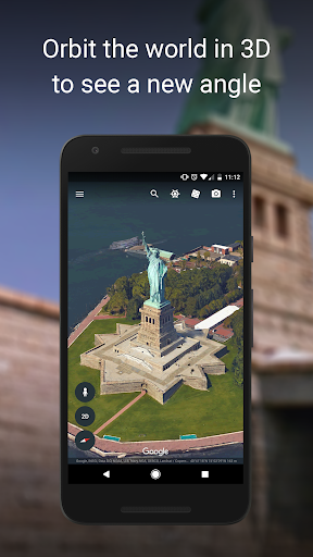
3D Terrain and Building Exploration: The app allows users to explore and navigate hundreds of cities in a three-dimensional space. It provides a more realistic view of structures and terrains, allowing for a more immersive and engaging experience.
Street View: One of the most captivating features is Street View, offering users a ground-level perspective in 360°. Users can virtually walk through streets and neighborhoods, gaining a realistic sense of different locations and creating an immersive experience.
Create and Collaborate on Maps: It enables users to create personalized maps by adding placemarks, creating tours, and sharing their findings with others. This collaborative aspect makes it an excellent tool for educators, researchers, and businesses.
Offline Viewing: While some features require an internet connection, it allows users to view previously loaded maps without connection. This offline capability ensures access to maps even in areas with limited connectivity.
Search and Discovery Tools: The app provides robust search tools, enabling users to discover specific locations, landmarks, businesses, and more. This makes it convenient for planning trips or conducting research about various places.
Layered Information: Users can access different layers of information, including geographical, historical, and ecological data. This feature allows for a more comprehensive understanding of specific areas or regions.
Integration with Google Services: It seamlessly integrates with other Google services, allowing easy access to saved locations, sharing features, and synchronization across different devices.
KEY FEATURES
The application allows users to observe the places on the map they want to find, and even many other places appear in the world.
Users are entitled to use to explore the world at home and give directions when they go to unfamiliar places, even travel.
Displays full information about the photos that the application posts and supports many different languages to let users know more information about the location they need.
Explore images of different planets on earth and see their movement around the earth in 360dgr panoramic view in high resolution.
Use data layers to define the population metrics of interest to you, and import large vector image files to chart GIS data using the spreadsheet importer quickly.
Create maps with advanced tools:
Compute distances and areas using measurement tools
Use Movie Maker to produce media collateral
Print high-resolution images for presentations and reports
Import large vector image files to quickly map GIS data
Map addresses with the Spreadsheet Importer
Frequent questions:
Can I use Google Earth offline?
Yes, you can use Google Earth offline. To do this, you will have to download the maps you want onto your smartphone.
What's the file size of the Google Earth APK for Android?
The Google Earth APK for Android takes up 32 MB. This lightweight size means that you can use the tool on almost any smartphone, even if the device does not have much free storage space.
Can I use Google Earth on PC?
Yes, you can use Google Earth on PC. Just download the exe. program for Windows or Mac from Uptodown to explore every inch of the world on your computer.
Can I go back in time with Google Earth?
Yes, you can go back in time with Google Earth. To do this, just access the image history by looking at the previous versions of each map on the timeline.
Conclusion:
With so many interesting and useful features, Google Earth is really not only an application to explore the world but also can help you a lot in every trip to new lands. Google Earth is definitely a tool that everyone will need!
More Information
- Size:32MB
- Version:3.5.0.0
- Requirements:Android
- Votes:280
Related topics
-
When you are traveling or experiencing a new place or activity, no one wants to stare at their phone or tablet the whole time. However, you want the memories of your trips and travel to last forever, and you want to share those memories with friends and loved ones back home. The best travel logs combine both worlds with stunning features and interfaces to document your memories, photos and videos of the places that you visit and simple, easy-to-use design. These some trip logging apps let you easily capture the memories, so you can get back to enjoying it in the moment.
-
The relentless flow of time remains beyond our complete command, an ever-shifting rhythm we can never fully master. Yet within our limited sphere of influence, we may still strive to govern our own small domain - and in doing so, perhaps we achieve a kind of mastery after all. For while the vast world extends far beyond our reach, the miniature universe we hold in our hands contains infinite possibilities of its own. True control may not mean dominating the entirety of existence, but rather perfectly curating the world we can touch and shape. The cosmos stretches endlessly outward, but within our grasp lies a personal cosmos waiting to be molded.
-
These must-have travel apps bring global adventures to your phone, making trip planning effortless and budget-friendly. Compare flights and hotels in seconds, access offline maps and expert city guides, or master key phrases in foreign languages. Read authentic tips from locals to uncover hidden gems before you arrive. Whether you're dreaming up future journeys or navigating current travels, these tools transform wanderlust into reality. With exclusive free premium features, your digital passport to discovery is ready - download now and let your next unforgettable journey begin!
Top Apps in Category
Popular News
-
Karryn’s Prison Gameplay Walkthrough & Strategy Guide
2025-10-28
-
Life in Santa County Game Guide & Complete Walkthrough
2025-10-28
-
Dreams of Desire Complete Walkthrough and Game Guide
2025-10-28
-
Era Hunter Gameplay Guide & Full Walkthrough
2025-10-28
-
Bulma Adventure 2 Full Game Walkthrough and Playthrough Tips
2025-10-14
More+

